Much to my grumbling resistance after being awaken by thunder and lightning I crawled out of bed at 5:45 am because I had yet been able to catch lightning on film and the opportunities were closing with the end of monsoon season. Headed to the outskirts of town so I wasn't right under the storm and turned on the video (there was little chance that clicking was going to capture what I wanted since it hadn't worked to date).
An interesting sight was captured shown by these back to back frames. There was a band of light that showed up horizontally. Not sure if it is a photographic phenomenon or a result of the lightning.
Double rainbow appeared.
Sunrises during a thunderstorm are always interesting.
The breaks in the storm make for spectacular views too.
Through the raindrop speckled window.
Tuesday, September 27, 2016
Sunday, September 25, 2016
More exploring...
Headed out to who know's where yesterday, choice between Nutrioso, AZ or the Chiricahua National Monument. What, you say? You've never heard of Nutrioso, AZ? Or if you have heard of it maybe you are asking why I would think of going there.
The reason I know of Nutrioso, AZ has to do with the morning news, specifically the weather report. In the list of cities showing the temperatures it lists Nutrioso, AZ and the temperatures are quite a bit lower than elsewhere. Thinking it must be up in the mountains I looked it up on google maps.
7,671 ft is the elevation, the population though is 26 according to the 2010 census. Why exactly would this little place merit mention on the list of weather cities? I don't know and that is why I thought of going there. Being an almost 5 hour drive and having got a late start I decided to go the Chiricahua National Monument even though I had been there before.
Off I went, to the top and back down, here are the pictures:

I didn't see this face until at home looking at the pictures on the computer. Happy little accident.
I feel an odd connection with these rocks. To get to the park required a long drive and traversing many mountains barricading to get to these rocks hidden in the center. They are fractured and yet standing. Yes, these rocks mirror my soul.
Not satisfied with my exploration I decided to take the road that goes from the park over to Portal, AZ. Five years ago it wasn't open due to the recent fire and danger of flooding (it was mid Monsoon season). This time it was open. The distance is 24.5 miles over a dirt road. Well at 15-25 MPH that is a really long drive I came to find out. At this time of year its not in bad condition but with 360 turns and really steep declines it is not a quick trip.
Fires had really opened up things and there were lots of flowers and grass and lots of deer.

The deer here are in beautiful condition, very healthy looking. Nice buck below, almost didn't get him.
There has been a lot of haze thee last couple of days, hard to see the distance clearly.
Another one of those happy accidents, didn't notice the limbs forming a frame around the rock I was shooting.

Beautiful area, even creeks with water in them. Pinery Canyon Road also known on Forest Road 42 was worth the drive.
The ensuing events of a flat tire and the search to find some place to fix it since those worthless spare tires are...well, worthless was another story. Thanks to a very kind couple and their chocolate lab for stopping and changing my tire and a great tire repair guy, Jesus Gandarilla East 2 West Towing & Repair in Lordsburg, NM for fixing my tire so I could get home. 352-262-5108 if you are in need of assistance.
Headed out to who know's where yesterday, choice between Nutrioso, AZ or the Chiricahua National Monument. What, you say? You've never heard of Nutrioso, AZ? Or if you have heard of it maybe you are asking why I would think of going there.
The reason I know of Nutrioso, AZ has to do with the morning news, specifically the weather report. In the list of cities showing the temperatures it lists Nutrioso, AZ and the temperatures are quite a bit lower than elsewhere. Thinking it must be up in the mountains I looked it up on google maps.
7,671 ft is the elevation, the population though is 26 according to the 2010 census. Why exactly would this little place merit mention on the list of weather cities? I don't know and that is why I thought of going there. Being an almost 5 hour drive and having got a late start I decided to go the Chiricahua National Monument even though I had been there before.
Off I went, to the top and back down, here are the pictures:

I didn't see this face until at home looking at the pictures on the computer. Happy little accident.
I feel an odd connection with these rocks. To get to the park required a long drive and traversing many mountains barricading to get to these rocks hidden in the center. They are fractured and yet standing. Yes, these rocks mirror my soul.
Not satisfied with my exploration I decided to take the road that goes from the park over to Portal, AZ. Five years ago it wasn't open due to the recent fire and danger of flooding (it was mid Monsoon season). This time it was open. The distance is 24.5 miles over a dirt road. Well at 15-25 MPH that is a really long drive I came to find out. At this time of year its not in bad condition but with 360 turns and really steep declines it is not a quick trip.
Fires had really opened up things and there were lots of flowers and grass and lots of deer.

The deer here are in beautiful condition, very healthy looking. Nice buck below, almost didn't get him.
There has been a lot of haze thee last couple of days, hard to see the distance clearly.
Another one of those happy accidents, didn't notice the limbs forming a frame around the rock I was shooting.

Beautiful area, even creeks with water in them. Pinery Canyon Road also known on Forest Road 42 was worth the drive.
The ensuing events of a flat tire and the search to find some place to fix it since those worthless spare tires are...well, worthless was another story. Thanks to a very kind couple and their chocolate lab for stopping and changing my tire and a great tire repair guy, Jesus Gandarilla East 2 West Towing & Repair in Lordsburg, NM for fixing my tire so I could get home. 352-262-5108 if you are in need of assistance.
Tuesday, September 20, 2016
Monday, September 12, 2016
Exploring....
Been sick for over a week and going stir crazy staring at the same 4 walls so decided to go for a drive. After looking at google maps decided on Garden Canyon where there is some petroglyphs and plenty of flora and fauna according to a post on tripadvisor.
Unfortunately the gate was closed. So wandered down another road and here is what I found:

Sierra Vista is surrounded by mountains to the East
to the northeast
to the southwest

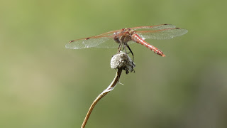
From the bigest views to the little views:
This picture turned out pretty awesome, even if I say so myself.
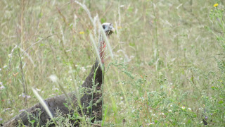
Movement out of the corner of my eye upon closer examination and lots of pictures turned out to be a bunch of turkeys.

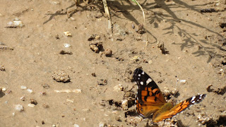
Butterflies/moths? they abounded by an actual running creek. The coloring on the different sides of the wings amazing. The face, not so much.
After my little outing it was back to my curling up on my couch!
Been sick for over a week and going stir crazy staring at the same 4 walls so decided to go for a drive. After looking at google maps decided on Garden Canyon where there is some petroglyphs and plenty of flora and fauna according to a post on tripadvisor.
Unfortunately the gate was closed. So wandered down another road and here is what I found:

Sierra Vista is surrounded by mountains to the East
to the northeast
to the southwest

From the bigest views to the little views:
This picture turned out pretty awesome, even if I say so myself.
Movement out of the corner of my eye upon closer examination and lots of pictures turned out to be a bunch of turkeys.

Butterflies/moths? they abounded by an actual running creek. The coloring on the different sides of the wings amazing. The face, not so much.
Saturday, September 3, 2016
Where is Lj now?
It came to my attention that this blog designed to advise where in the world Lj is now, doesn't. So, the update is that I am in Sierra Vista, AZ. SE Arizona, about 30 miles as the crow flies to the Mexican border, about 2 hours to the New Mexico border and 70 miles by road from Tucson.
Sierra Vista is surrounded by mountains in varying degrees of closeness. About 45,000 +/- population; 4,633 in elevation; the hummingbird capital of the United States (have not seen even 1 yet) and was the site of the first McDonald's drive thru which opened in 1975.
The mountains contain remnants of old towns, rolling fields/pastures as well as a variety of different rock types. High desert it is cooler than Tucson. 3 English congregations and 1 Spanish.
So there you have a run down of where I am and here are some pictures:
North American Monsoon season is July and August. Typically only for a short time during the day. Torrential downpours and thunderstorms.
Awesome sunsets and sunrises (since Arizona doesn't do the time change thing it comes really early in the summer, haven't got a picture of one yet, lol).
Arizona is not usually associated with rolling fields but there are spots and especially during Monsoon season it is very green.
Even the fallen part of this awesome tree is thriving.
Just a cool tree trunk.

"River" may be greatly exaggerated, "Puddle" would be a more apt description.
A volleyball net in the most unexpected place.
Horses enjoying free range.
It came to my attention that this blog designed to advise where in the world Lj is now, doesn't. So, the update is that I am in Sierra Vista, AZ. SE Arizona, about 30 miles as the crow flies to the Mexican border, about 2 hours to the New Mexico border and 70 miles by road from Tucson.
Sierra Vista is surrounded by mountains in varying degrees of closeness. About 45,000 +/- population; 4,633 in elevation; the hummingbird capital of the United States (have not seen even 1 yet) and was the site of the first McDonald's drive thru which opened in 1975.
The mountains contain remnants of old towns, rolling fields/pastures as well as a variety of different rock types. High desert it is cooler than Tucson. 3 English congregations and 1 Spanish.
So there you have a run down of where I am and here are some pictures:
North American Monsoon season is July and August. Typically only for a short time during the day. Torrential downpours and thunderstorms.
Awesome sunsets and sunrises (since Arizona doesn't do the time change thing it comes really early in the summer, haven't got a picture of one yet, lol).
Arizona is not usually associated with rolling fields but there are spots and especially during Monsoon season it is very green.
Even the fallen part of this awesome tree is thriving.
Just a cool tree trunk.

"River" may be greatly exaggerated, "Puddle" would be a more apt description.
A volleyball net in the most unexpected place.
Horses enjoying free range.
Subscribe to:
Comments (Atom)


